|
CCBT Photo Gallery
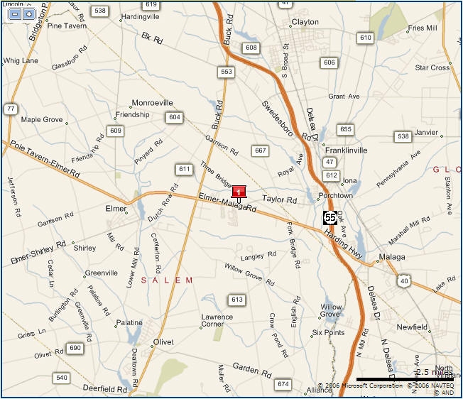
Directions:
NOTE: We've had reports of various GPS devices linking user to
incorrect location; therefore,
we recommend printing the map below or using these coordinates:
DD (decimal degrees): Latitude: 39.594600 Longitude: -75.120800
DMS (degrees, minutes, seconds) : N 39° 35' 43" W 75° 7' 36"
You can also
try using
http://map.ccbtnj.org/ and input your
current location for directions (by GoogleMaps) to CCBTNJ.
From all points North:
Take Route 55 South to Exit 39 B (US-40), bear right onto Rt. 40 West.
From the exit go approximately 2.5 Miles, the church is on the
right, across from Harding Woods Mobile Home Park
From all points South:
Take Route 55 North to exit 39 B (US-40), bear right onto Rt. 40 West.
From
Exit go approximately 2.5 Miles. The church is on the right, across
from Harding Woods Mobile Home Park
From the West: Take Rt.
40 East - We are approximately 2.5 Miles from the town of Elmer.
The church is on the left across from Harding Woods Mobile Home
Park.
188 Route 40 ● Newfield NJ
08344
856-358-2228
|